Geography
·
The Invisible Rivers Shaping Your World
Medium
7 min
The Invisible Rivers Shaping Your World
There are rivers inside the ocean moving more water than every river on land combined, and they decide where you can live.
Share
London and Calgary sit at roughly the same latitude. Calgary gets brutal winters. London grows palm trees. Same distance from the equator. Wildly different worlds. The difference isn't geography — it's a river you've never seen.
The ocean isn't just a big flat pool of water sitting still. It's full of fast-moving rivers — called ocean currents — that flow through the saltwater like highways. Some are near the surface. Some run thousands of meters deep. Some are warm. Some are cold. And together, they move more water than every river, lake, and stream on land combined. By a factor of a thousand.
These currents aren't random. They follow predictable paths, year after year, century after century. And because water carries heat incredibly well, wherever these currents go, they drag the climate with them.
Make your call
London and Calgary are at the same latitude. So why does London grow palm trees while Calgary endures brutal winters? What's actually making the difference?
A
London sits on a peninsula, and land surrounded by water always stays warmer due to the ocean's sheer mass
B
A warm ocean current runs along Western Europe's coast, constantly releasing heat into the air above it
C
Prevailing winds carry warm air up from Southern Europe, insulating Britain from Arctic cold
Picture the Atlantic Ocean. Now draw a giant loop. Warm, shallow water flows northeast from the Gulf of Mexico toward Europe — this is the Gulf Stream, and it's the invisible river behind that London-versus-Calgary mystery. When it reaches the cold North Atlantic, it releases its heat into the air (which is why Western Europe stays mild), then cools, gets denser, sinks to the ocean floor, and flows back south as a deep, cold current along the ocean bottom. Then it warms up again near the equator and rises back to the surface. One giant conveyor belt. Always moving. Always recycling heat.
Currents aren't just driven by temperature. Salt matters too.
Warm water near the equator evaporates constantly, leaving the salt behind. That makes tropical surface water saltier — and saltier water is denser. When this dense, salty water flows north and cools down, it becomes so dense it literally sinks to the ocean floor and drives the entire deep circulation system. Remove the salt difference, and the whole conveyor slows down or stops.
This is why climate scientists are watching Greenland's ice sheet melt with close attention. Measurements show significant freshwater input into the North Atlantic from accelerating ice loss. That freshwater dilutes the salt concentration — and models suggest it could slow a circulation system that has kept Europe's climate stable for thousands of years.
Key Insight
KEY INSIGHT: Ocean currents are driven by two forces working together: temperature differences and salt concentration. Scientists call this thermohaline circulation (thermo = heat, haline = salt). If either driver gets disrupted enough, the whole system can shift — and when it does, entire civilizations feel it.
Example
In the 1400s and 1500s, European explorers didn't just sail wherever they felt like. They couldn't. Sailing against a major ocean current in a wooden ship was brutal — slow, expensive, and often deadly. So they learned to read the currents and use them like free highways.
Christopher Columbus didn't sail straight west from Spain. He dropped south to the Canary Islands first, caught the North Equatorial Current flowing west, and rode it all the way to the Caribbean. On the way back, he swung north to catch the Gulf Stream flowing east. The whole Age of Exploration was basically a lesson in current-surfing. The empires that figured it out first got rich. The ones that didn't, didn't.
Today, cargo ships still do the same thing — optimizing routes around currents to save fuel and time. The ocean's invisible rivers are still the backbone of global trade.
Currents also explain why some of the world's richest fishing grounds sit in the most unexpected places.
When a cold, deep current rises to the surface — a process called upwelling — it drags up nutrients from the ocean floor that have been sitting there for centuries. Those nutrients feed plankton. Plankton feeds small fish. Small fish feed big fish. The result is an explosion of marine life.
The coast of Peru is one of the most productive fishing regions on Earth — not because Peru did anything special, but because the Humboldt Current runs cold and nutrient-rich right along its shore. Same story off the coast of West Africa, and Namibia, and the Pacific Northwest.
And when El Niño hits — a periodic warming of the Pacific that suppresses upwelling off South America — those fisheries collapse almost overnight. Entire economies built around fish suddenly have no fish. Not because the fish did anything wrong. Because a current shifted.
Sources
Images from Wikimedia Commons. Attribution required by license.
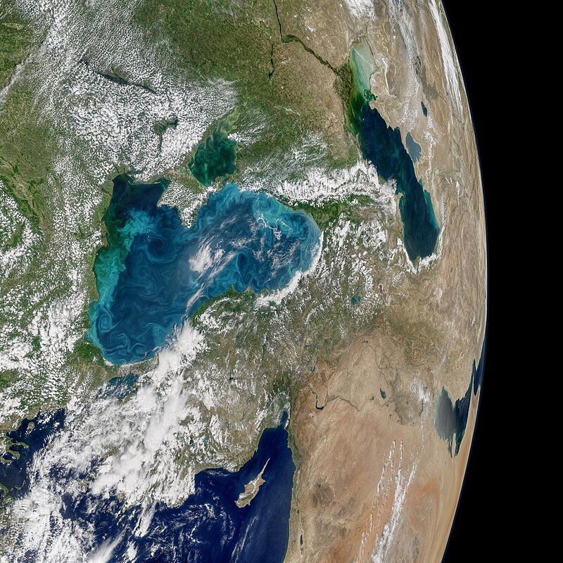
Most summers, jewel-toned hues appear in the Black Sea. The turquoise swirls are not the brushstrokes of a painting; they indicate the presence of phytoplankton, which trace the flow of water currents and eddies.
On May 29, 2017, the Moderate Resolution Imaging Spectroradiometer (MODIS) on NASA’s Aqua satellite captured the data for this image of an ongoing phytoplankton bloom in the Black Sea. The image is a mosaic, composed from multiple satellite passes over the region.
Phytoplankton are floating, microscopic organisms that make their own food from sunlight and dissolved nutrients. Here, ample water flow from rivers like the Danube and Dnieper carries nutrients to the Black Sea. In general, phytoplankton support fish, shellfish, and other marine organisms. But large, frequent blooms can lead to eutrophication—the loss of oxygen from the water—and end up suffocating marine life.
One type of phytoplankton commonly found in the Black Sea are coccolithophores—microscopic plankton that are plated with white calcium carbonate. When aggregated in large numbers, these reflective plates are easily visible from space as bright, milky water.
“The May ramp-up in reflectivity in the Black Sea, with peak brightness in June, seems consistent with results from other years,” said Norman Kuring, an ocean scientist at NASA’s Goddard Space Flight Center. Although Kuring does not study this region, the bloom this year is one of the brightest to catch his eye since 2012.
Other types of phytoplankton can look much different in satellite imagery. “It’s important to remember that not all phytoplankton blooms make the water brighter,” Kuring said. “Diatoms, which also bloom in the Black Sea, tend to darken water more than they brighten it.”
Norman Kuring / NASA · Public domain
Driven by changes in temperature and salinity, thermohaline circulation powers a huge current system known as the global ocean conveyor belt. It transports heat from the tropics to the poles in surface currents, and then cold water is transported back to the equator through deeper currents. The ocean system plays a critical role in regulating the global climate.The Atlantic Meridional Overturning Circulation (AMOC) – a complex network of currents, including the Gulf Stream – is a key component of the global ocean conveyor belt.The formation of North Atlantic Deep Water in the Nordic and Labrador Seas is fundamental to the AMOC, but it is this process that is now under threat. Rapid warming and freshening from melting ice and increasing freshwater runoff are disrupting this process, putting the AMOC at serious risk.ESA’s Next Generation Gravity Mission could provide the first opportunity to directly track the AMOC.Read full story: New ESA gravity mission set to detect weakening ocean conveyor
European Space Agency · CC BY-SA 3.0 igo
Quiz yourself